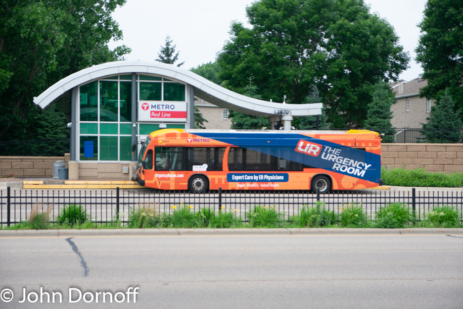
Planning for this project started in the late 1990’s with a study on both light rail and bus options. Once again Bus Rapid Transit was promoted as “just like light rail” but with lower upfront cost. Dakota County officials were banking on the BRT to bring the same type of development that a light rail line would have brought. The route was estimated to carry 975 passengers per day at the opening of the route and by 2017 be carrying 1600 people. While METRO transit in February was bragging about its increased ridership on its light rail trains and on its new Route A, yet there was no mention of the Red Line beyond that fact that ridership decreased on most of the agencies transit routes. To date the Red Line continues to carry less than a 1000 people per day with an average of 8 people per trip which even the smallest transit systems would consider very week ridership.
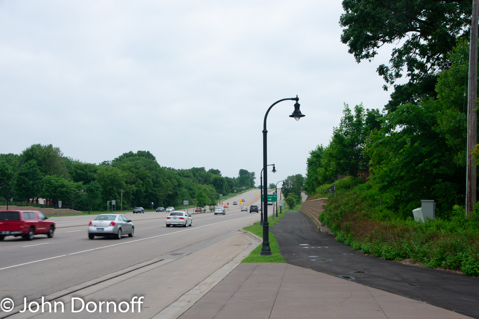
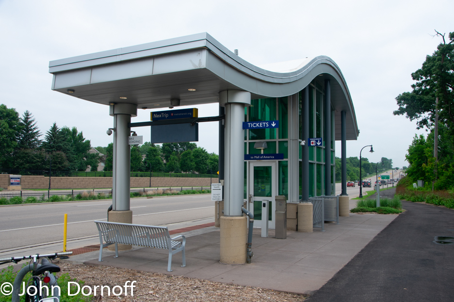
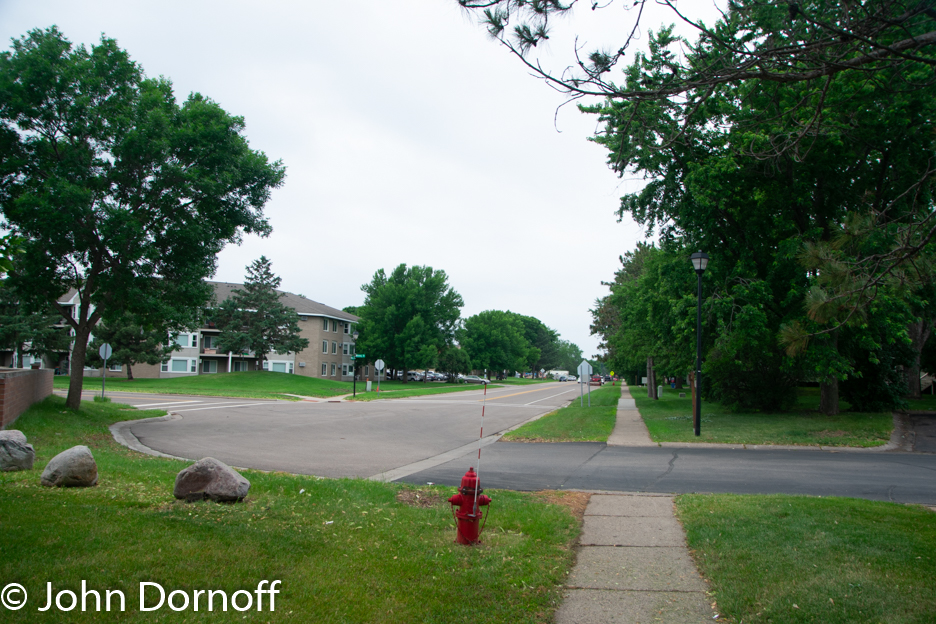
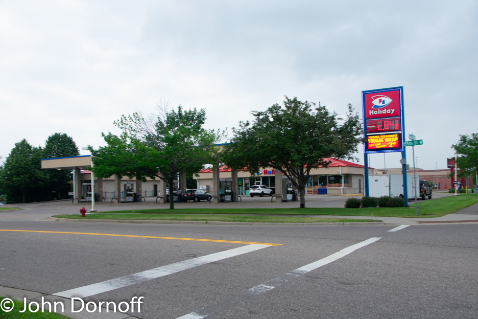
So why is this line carrying so few people? Just look at one of its stops that is just north of 140th Street West (on a side note Google shows the bus stop on the southbound side closer to the intersection that it actually is). If you will notice there is not direct pedestrian access between the two sides of the street from the bus stops. You have to walk down to the intersection walk across Cedar Avenue and back up to the bus stop. While this is only a 0.3 mile walk, it involves crossing an extremely busy and fast road across multiple lanes and multiple turn lanes. I will give the traffic engineers credit in that they did add pedestrian refuges between the two sides of the highway but who would want to be stuck in the middle of that road with the fast moving cars on each side?
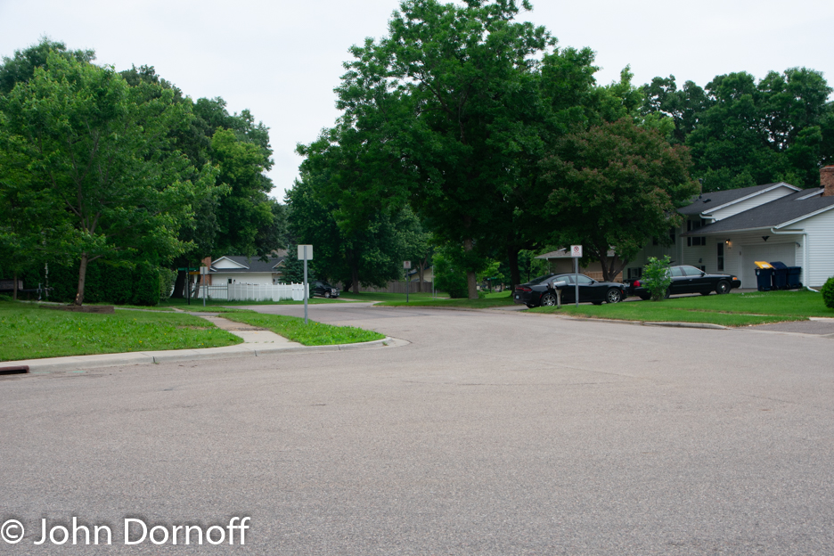
If you live on the east side of the street you’re in luck because you can access the cul-de-sac directly from the bus stop. If you live on the west side of the street you’re not as fortunate as there is no direct access from the bus stop to housing located right on the other side of the sidewalk (although you could cut through some of the forest to the south of the complex).
If you will zoom out from the image you will see the entire area is made up of the worst of suburban cul-de-sac development. The developments are built to limit connectivity and force the use of an automobile since there is little practical way to use transit. To the south of 140th Street West and west of Cedar Avenue there is assisted living apartments that limit the residences freedom as there is virtually nothing within walking distance and thereby restrict residences to be at the mercy of the complexes shuttle busses or the Minnesota Valley Transit bus service that provides only limited service.
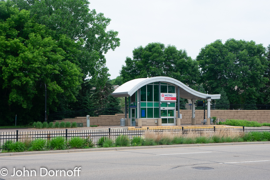
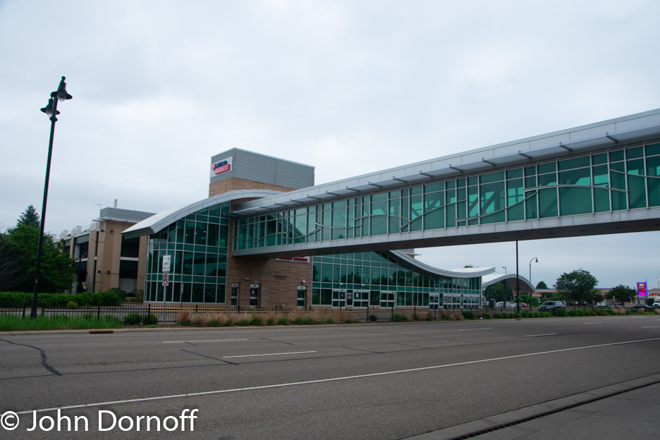
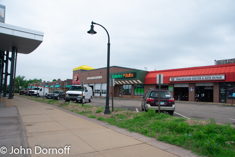
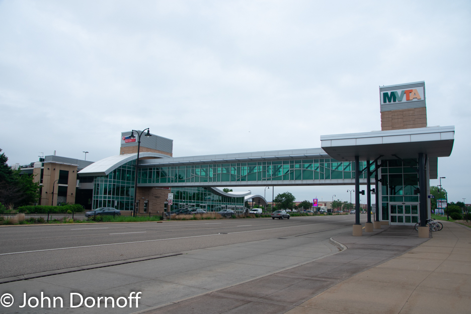
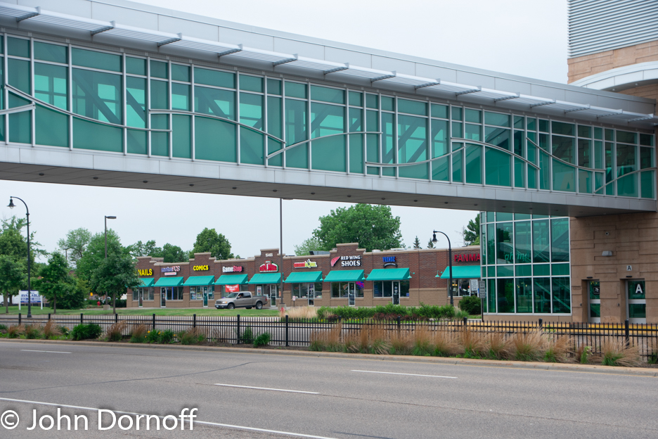
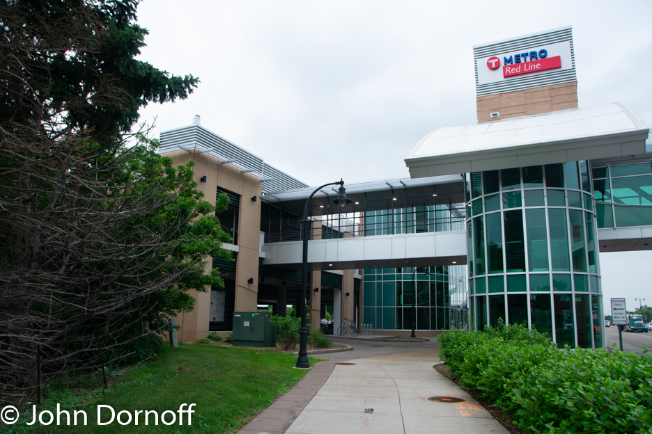
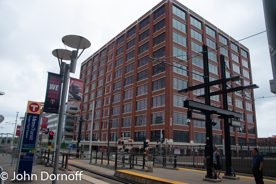
The situation is better at the Apple Valley Transit Center as there is a pedestrian bridge across the highway for the use of transit customers and there is multi-family housing that is within an easy walking distance of the center. However, most of the area is surrounded by suburban retail that gives only lip service to walkability (there is a connection to the sidewalk but who would want to walk down the sidewalk with it sits next to a high speed road).
What is difficult to decide is that if the Apple Valley Transit Center is a true transit center or more of a glorified park n’ ride lot. While I can only comment for the time I observed the center which was during a morning rush hour, probably 99% of the passengers boarding buses at the transit center parked in the parking lot/garage and then boarded the express bus to downtown Minneapolis. One of the local Minnesota Valley Transit buses which used a cutaway bus boarded one passenger and a total of 4 passengers boarded the two Red Line buses that departed while I was observing the station.
After having a chance to ride the Red Line, explore its station areas, and look at the numbers, here are the problems I see with the line:
1. The built environment is not conducive to a high frequency bus line that requires a transfer to reach your final destination if your destination is not the Mall of America.
2. Not only does it require a transfer at the Mall of America but going back to the problem of the built environment, since most people have to or will drive to get to the transit line, a second vehicle transfer discourages ridership.
3. Because of numbers 1 & 2, the route is not attracting choice riders. If you are going to downtown Minneapolis or St. Paul you are not going to use the Red Line just to make another transfer to the Blue Line and instead will take the direct bus.
4. Because the area is largely built out in an automobile centric environment, there is little that the built environment is going to change in the next few decades. While change may come it will take decades for it to happen to this area.
5. From my observations while admittedly during a short period of time, a majority of the riders on the Red Line are those that have to take it.
6. The Red Line uses a separate brand of buses from the rest of the MTVA and METRO itself which leads to increased cost from maintaining a separate parts supply. METRO on its ARLT routes (Arterial Bus Rapid Transit) uses Gillig Advantage BRT’s a common bus in the METRO fleet.
The question is, had the Blue Line been extended from the Mall of America to the Apple Valley Transit center instead of building a separate and cheap BRT line, what would have changed to make the investment worthwhile?
1. First of all, the built environment would still be the built environment. Would have the presence of a light rail line encourage some of the existing land use to change more quickly? Possible but only if the government agencies would have encouraged it to happen although it would more likely to happen with a light rail line.
2. With a one seat ride from the Apple Valley Transit Center to downtown, more choice riders would make the decision to ride the Blue Line since they would not have to make a second transfer (after the one from their car to transit).
3. Finally, Minnesota Valley Transit Authority would have been able to reduce service to downtown Minneapolis and reallocate those resources to provide better service to places such as St. Paul, and possibly other major employment areas that are not directly accessible to the light rail line.
In addition an extension of the line to the community of Lakeview is now underway.
It will appear that the Lakeview extension would do little to change the performance of the Red Line. Looking at the route from the Apple Valley Transit Center down to Lakeview a majority of the route will travel past agricultural land although some of that agricultural land is now being turned into housing. However the housing developments are just as hostile to transit as is the developments along the existing Red Line. In addition there is very little existing transit service to connect with the Red Line.
It also appears that many of the city council members are hostile to transit. One of the them stated that he is against transit oriented development because it dictates to developers what can be built using the tired statement that “the free market should determine what gets built” but turning a blind eye to the fact that since Transit Oriented Development is largely illegal by most zoning codes, you are effectively eliminating a true free market.
In addition the line will end at an industrial park on the southeast side of Lakeview. While the industrial park is a major source of employment one of the problems of serving industrial parks with transit is the extreme peaks and valleys of the ridership. There are big peaks when people are going to work at the parks or leaving them but otherwise there is virtually no ridership. That is why industrial parks should not be a destination with transit but instead be something that is served through on the way to more important destinations with consistent ridership. The route will not serve the heart of Lakeview or its neglected and ignored downtown area or the more populated areas near what is left of the downtown.
It appears that the extension of the Red Line will do little to help improve the routes rather lack luster ridership. The question then arises is there anything that can be done to fix the Red Line and make it a better bus line?
One suggestion that has been proposed is to extend the line from the Mall of America into downtown Minneapolis. Metro Transit is currently doing design work on route D which would travel from the Mall of America through downtown Minneapolis to the Brooklyn Transit Center on the north side of Minneapolis. On the one hand this will give customers a one seat ride from downtown and places in between it would also create a route serving two different markets one so called “BRT” and the other “aBRT”. While neither is truly BRT and the nature of the two sections would be totally different. The existing Red Line is largely suburban with the extension rural, while the section north of the Mall of America being largely suburban & urban. In addition with the length of the route it would be easy for buses to get off schedule and one major incident along the route could cause major chaos.
Another option would be to extend the route to downtown St. Paul via Minnesota Highway 5/7th Street West. This would have the benefit of not duplicating the Blue Line and provide improved service from the Mall of America to downtown St. Paul replacing route 54. However, alternating route 54’s extend the beyond downtown St. Paul to the Maplewood Mall Transit Center so it would need to be determined if you were to continue running route 54 from downtown St. Paul to the Maplewood Mall, increase service to Maplewood Mall, or just short line alternating buses as it is presently done. The major downfall of this suggesting is once again the mismatch between the service on the Red Line and route 54 and the nature of the two routes similar to what was discussed with Route D to downtown Minneapolis.
One final solution would be to turn the route over the Minnesota Valley Transit Authority. After all, they currently operate the route and the route is primarily in their service area. The route does not directly duplicate their existing bus service which is concentrated on commuter routes to the downtown areas and the University of Minnesota and local feeder routes that serve the most transit dependent of their service area.
The problem is that there is just no clear cut solution to the issues facing the Red Line. Because it was not built as an extension of the Blue Line it has to stand on its own as a transit line traveling through low density and poorly connected suburbs and it has to compete against other transit services and the automobile.
The question is what lessons can be learned from the performance of the Red Line that can be applied when planning for any type of transit line? Here are some takeaways to consider and questions that should be asked when designing a project such as this:
1. What is the purpose of the line?
2. What is the market for the line?
3. Is this line going to compete against existing services?
4. What will the lines niche and selling position be?
5. Is this line going to be an improvement over the existing service?
6. Why would a customer use this service instead of existing service?
7. Will the service require capital expenditures that will increase maintenance costs? (I.e. buses exclusive to the route that will require a special parts supply).
8. Does it make sense to create an entirely new service or will an extension of an existing service make more sense?
9. How will customers access the line and does the built environment enable or hinder passengers using the line?
The Red Line is a perfect example of a so-called BRT that was put in to be “just like light rail” but has failed to live up to the hype, and whether its new extension will have any effect on its performance is questionable at best. The line was designed on the cheap and its shows and so does its performance.
Over
the years it seems that there is always something on the horizon that is going
to solve all our urban design problems. In the early 1900’s the implementation
of zoning ordinances was supposed to be the magic bullet that would solve the difficulties
facing cities at the time. Then there were highways, exclusionary zoning, easy
to get mortgages, urban renewal, and pedestrian malls among others that were
all going to solve our urban problems. Today we know from history that while
each of these things had their benefits, they also came with unintended
consequences and in the long run did not solve our urban problems. Today we
have a new magic bullet on the horizon that many feel is going to revolutionize
the world and solve all of our urban problems – the autonomous car.
Autonomous
cars could have a major effect on our cities but maybe not in the way many
people think they will. My first planning professor had a favorite saying, “What
do we know about the future…nothing” and when it comes to autonomous cars there
are those that believe that the adoption of autonomous cars will revolutionize
our cities for the better. But as with all technological advances there comes a
cost and what the final cost will be we will not know for some time. In
addition, the changes we see will be different than envisioned and like so many
of the magic bullets from the past, the unintended consequences may be more
severe than we expect.
According
to the utopian dreams of many who think that autonomous cars will be the savior
of our urban areas as they will eliminate the need for parking, eliminate
congestion, and make our cities safer to walk and bike. There will be so little
traffic on the streets of your downtown area that the urban area will just come
alive. Of course this vision sounds wonderful and what urban designer/urban
planner doesn’t want our urban areas to be transformed into the perfect place
that people will want to be around.
There
would be many benefits to the implementation of autonomous cars. For the elderly
that should no longer be behind the wheel of a car, an autonomous car would
allow them to have the mobility when driving is no longer an option. Often
times the elderly can become isolated because of their loss of driving
abilities, especially when they want to age in place in a built environment
that was not designed for it.
Another
example of a situation where autonomous cars would be an advantage would be
parents with children. Rightfully Uber and Lyft do not allow anyone under 18 to
set up an account or travel along in a vehicle. Being the father of two teenage
girls I would not allow my daughters to travel alone in a car with strangers
although there has been undercover investigations showing that drivers from
both companies will accept passengers alone that are underage. However with
autonomous cars, say a mother has a child that is sick, a car could pick up her
children and bring them home safety.
However,
what really happens will probably be something truly different. There is some
that fear that the advent of autonomous cars will make things worse not better.
There is the fear that the implementation of autonomous cars will cause the
urban environment to become even more auto-centric than it already is.
Think
about how our urban environment has changed with each development in
technology. First you had the streetcar suburbs, then as automobiles became
more the transportation of choice people moved farther and farther out. So will
the implementation of autonomous cars make this situation even worse?
When
it comes to the cars themselves, there are literally dozens if not hundreds of
articles dealing with the problem of the cars themselves including privacy
issues, a public that is skeptical, the lack of laws concerning the cars, lack
of clear responsibility, moral and ethical questions on how the cars will
respond to situations, and when hackers will start targeting the cars and what
damage will be done.
Autonomous
cars are coming and we have no idea how those changes are going to affect our
built environment. What we should not do is expect autonomous cars to be the
magic bullet to solve our urban design problems. While autonomous cars will
help solve some problems they may create their own problems, like all
technological advances. Instead of expecting autonomous cars to solve our
problems we need to be working today on solving those problems and making the
built environment a better place.
Hundreds of Millions and even Billions of dollars
are spent to build new sports stadiums around the country and each time it
seems that the new stadium is more elaborate than the last one to be built. In
2009 the New York Yankees bought a new stadium that cost a whopping $1.5
billion dollars while in 2017 Atlanta built a new stadium for the football and
soccer teams which came in at $1.6 billion dollars. Today I plan to talk about
the football stadium in Minneapolis that cost $1.1 billion and the baseball
stadium that opened on 2010 that cost a measly $555 million. While the cost can
seem astronomical I am not going to be talking about the construction cost but
instead I am going to discuss the urban environment around the stadium.
While
sports stadiums seem to create a lot of excitement when they are proposed and
cities are willing to throw whatever money they can to get a stadium built in their
location, like convention centers they often sit empty a majority of the time
and can create dead zones around them. While on a trip to Minneapolis last
summer, I was able to a take a close look at the area around the stadiums and
see exactly what the urban environment looks like today.
First
let’s take a look at the new football stadium. The stadium opened in 2017 and
hosted the Super Bowl in 2018. For those not familiar with Minneapolis the
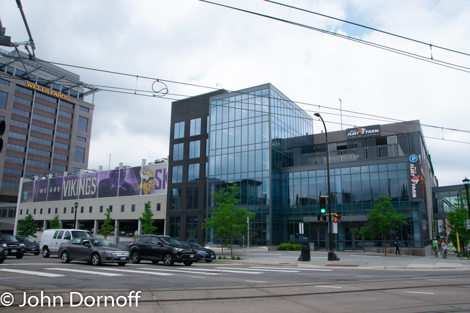
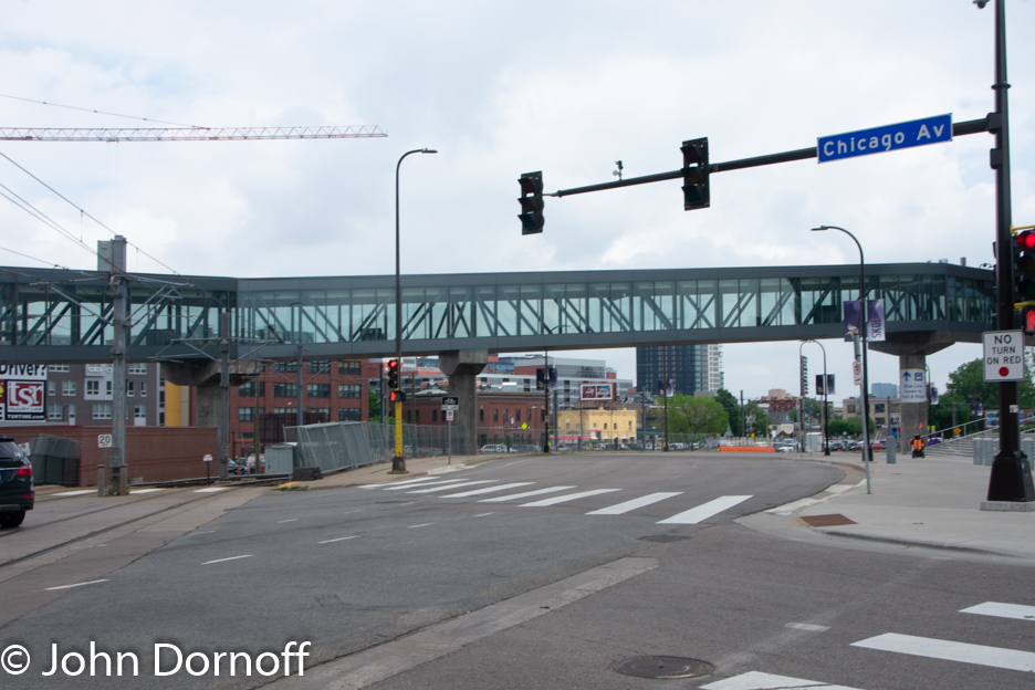
stadium sits to the east and slightly to the south of downtown Minneapolis. The
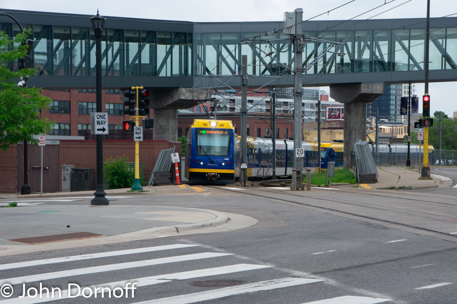
biggest activity center around the the stadium is a light rail station which is
the primary station for passengers to transfer between the two light rails. There
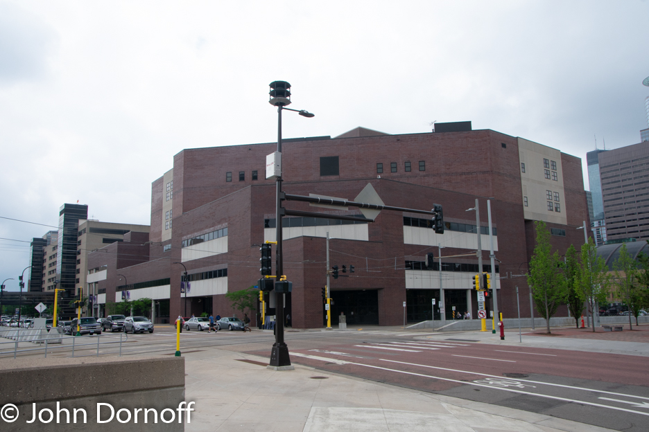
are a few buildings nearby, mainly the county Juvenile detention facility and a
hospital which are not exactly the best attractions if you want to build a
walkable community.
 |
| Green line light rail train arrives at station in front of the stadium. |
 |
| Looking at the empty plaza in front of the station. |
 |
| Another look at the plaza with the stadium to the right and light rail station to the left. |
 |
| Looking north from the light rail station toward the parking garages which is the closest use to the stadium. |
 |
| Looking northeast along Chicago Avenue. |
 |
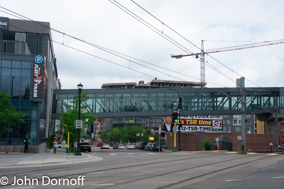
| Skywalk leading from the stadium to the parking garage. |
 |
| Light rail train going under the skybridge. |
 |
| Looking north toward the Wells Fargo buildings which have no active uses. |
 |
| A closer look at the Wells Fargo Building |
 |
| Looking northwest through the commons are toward downtown. |
Taking a look at the good map and the accompanying
pictures you can see that from the light rail station you are facing a pretty
desolate setting. Looking northwest from the station you have two open spaces
which in themselves are good if there is something to bring life to them,
however except for one apartment building along Fifth Avenue there is not much.
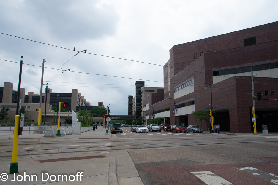
Turning south there is the Juvenile Detention center, the county hospital and a
lot of parking lots. Going north from open space you have two bank office
buildings with nothing on the street level, and a parking garage. The good news
is once you get to South 3rd Street and Park Avenue there are
restaurants and hotels but you have to get past the parking garage first which
also has no ground level activity to put more people on the street.
Continuing
northwest toward the downtown area things do not get better right away. The
blocks between 4th Avenue and 3rd Avenue are lined with
city, county and federal offices which can also be a killer to the urban
environment. Most of these buildings are only occupied during the week between
8 and 5 and have no ground level activities. There are a couple of plazas, one
in front of the Federal Court House and the other in front of the county
government center, but once again there is not enough street life to make these
plazas valuable most of the time.
 |
| Juvenile Detention Facility |
 |
| Looking southwest along Park Avenue. The Juvenile Detention Center is located to the right and parking lots to the left. |
 |
| Looking along S 5th Street toward downtown |
 |
| Looking northwest across the Commons. |
Now turn your
attention to the baseball stadium that is located on the northwest side of the
downtown area, basically on the complete opposite side of downtown from the
football stadium. There is probably no ideal spot for something like a sport
stadium or convention center, but the baseball stadium in Minneapolis probably
comes as close as you get.
The
stadium is located between a highway, an elevated street, a power plant and
another elevated street. The baseball stadium has even better transit access
than the football stadium as it is the terminal of the Northstar Commuter Rail
and both light rail lines. Eventually both light rail lines will be extended
beyond this area but both have been controversial. These light rail stations
can be extremely busy during rush hour with passengers transferring to
Northstar and of course during baseball games but beyond that there is little
activity in the area beyond one office building located north of the stadium
and the light rail stations.
 |
| Light Rail train at the light rail station in front of the baseball stadium. |
 |
| Looking southeast along North 5th Street past the stadium toward the parking garage and interstate. |
 |
| Looking toward the Northstar Station entrance. |
 |
| Looking northwest along North 5th Street. |
 |
| Looking southeast along baseball stadium. |
 |
| Looking toward the north from the baseball stadium. |
 |
| Looking past the baseball stadium toward the parking garage and downtown. |
 |
| Office building across the light rail tracks and North 5th Street from the stadium. |
 |
| Looking toward the second office building across from the stadium. |
The advantage the baseball stadium has over the
football stadium is that you have a much shorter walk to get to a booming urban
environment. If you leave the stadium area from the North 5th Street
side with the light rail station you do have to walk past a parking garage
which once again brings no life to the street but it is also serves as a cap
over Interstate 394 so it can be considered an improvement over having to walk
over a barren highway overpass. The largest entrance to the stadium empties out
onto North 7th Street and using this entrance you do have a slightly
longer walk to reach a thriving urban environment. From that entrance you cross
over a semi-cap over Interstate 394 then pass the parking garage on one side
and the basketball arena on the other to reach a flourishing urban environment.
Fortunately you only have to pass a corner of the arena to reach restaurants
and other urban life where there is much more activity on the street.
Another
facet of both stadiums that robs street life is that all the parking garages
for the stadiums are connected to the respective stadiums via skywalks. While
you can argue that it is necessary for the football stadium due to the weather
in Minneapolis during the winter, it is a little harder to argue that point for
the baseball stadium. Looking at the street view image shows that moving
automobiles was put ahead of the pedestrian environment.
Let’s
make it clear I am not disparaging the stadiums themselves. While I was in
Minneapolis/St. Paul during the summer I attended a game at the baseball stadium.
The stadium itself is terrific and like many purpose built baseball stadiums
over the last 20 years, no matter where your seats are you are close to action
no matter where you sit. Also, while I am not a fan of the way many stadiums
get financed and I question that they really bring the economic development
some people feel they do, there is no reason why the stadiums cannot be built
and designed to better create a more vibrant urban environment.
In time
the urban environment around the football stadium may greatly improve. The
owner of the football team Zygi Wilf has stated he is interested in
redeveloping the area around the football stadium. Hopefully this will bring a
better urban atmosphere to the area.
The two
stadiums in Minneapolis are a perfect example of how stadiums can create dead
zones in the urban surroundings. Most cities have something that will create
dead zones such as a sports stadium, convention center, music halls, live
theaters, or other similar uses. However, it does not have to be a dead zone if
it blends into a vibrant urban environment. But if it’s in a sea of parking, or
in an area where few people walk, it will contribute to being a dead zone
instead of bringing more life to the area.
 |
| Nederlands: Luchtfoto van Nederlands hoofdkantoor Bosch Rexroth (Photo credit: Wikipedia) |
One of the most difficult jobs of effective transportation planning, is the compromise between creating good environments for active transportation and transit while at the same time taking into considerations the need of freight carriers such as trucks that provide an important economic tool for many communities.
A great example of the problem areas for this compromise is in industrial areas. Industrial areas see a large amount of freight traffic (hopefully both on rail along with trucks) but you also need workers in industrial areas but they can be extremely difficult to serve with transit. Many transit advocates don't see the need for industrial areas and would love them to just go away. The problem with this line of thinking is that industrial areas tend to be the best sources of jobs that can lift people out of poverty. They provide a good paying jobs that do not require a college education.
The question is how do you serve industrial areas with transit and consider the last mile problem? One of the problems with transit service in these areas is that most of the ridership occurs only during shift changes which means if the industrial area is the primary point of travel for a transit line, it will only be busy during certain times of the day and run empty the rest of the time. There is a couple of solution to this problem.
One is to ensure that the industrial area is not the primary destination of the transit route. For example TriMet route 16 in Portland travels through the Northwest Industrial District but also serves downtown, the St. Johns area, Linnton and Sauvie Island. Two other routes the 15 and the 77 do terminate in the area but they are long routs and the industrial district makes up only a small portion of their total route mileage.
A second solution is to provide a shuttle service to the industrial area from a major transit stop. Companies such as Intel and Nike provide shuttle services from MAX light rail stations in Portland to their transit unfriendly campuses. Another example is the Burbank, CA Metrolink Commuter Rail station that sees a large number of company vans providing service from the train station to their offices although in this case they are not in industrial unfriendly industrial areas. In the cases cited the service is only provided by a specific company for their employees. A third example is in the Chicago Suburbs were employers pay the PACE transit agency to provide shuttle service from train stations to their businesses and these can be used by anyone willing to pay the fare.
Another problem presented by industrial areas is access by active transportation such as walking and bicycling. While few people will probably walk all the way to the industrial area from their homes, they may have to walk a distance from the bus stop to their place of employment and many times there is few if any sidewalks. A bigger problem is the conflict between trucks and bicyclist. Industrial areas can be congested with truck traffic that makes it dangerous for bicyclists. Trucks are large and have a hard time seeing cyclist in their mirrors. The best solution in this case is to provide dedicated infrastructure for bicyclists so they are separated from the trucks but not may not always be possible.
When bicyclists and trucks do have to share the road one of the most dangerous times is when a truck is making a turn because once the cab of the truck is at an angle it is very difficult for the driver to see what is on his right side. While there is no fail safe solution to this the problem, there is some relatively inexpensive things that can be done to increase safety. One would be to install mirrors along driveways giving truck drivers an additional way to see in their blind spots and the other would be put up more signage warning bicyclist and trucks of the dangers. A final idea would be an educational campaign that would teach both truckers and cyclists how to be safer around each other. The problem here is reaching the large number of long distance truck drivers who may come into the area only occasionally.
Industrial zones are important part of our economy but create unique transportation challenges especially when trying to serve them with transit and adding active transportation. It can be done but it takes cooperation from all parties to make a system that works.
A couple of months ago a major anniversary took place that I let pass by without any fanfare mainly because how busy I have been over the summer and continue to be. The anniversary that took place on August 4th when this blog turned 10 years old.
Back then it was called Transit in Utah and was started to discuss transit issues in the Salt Lake region and other parts of Utah. Having been a transit and rail passenger advocate for many years, it was an opportunity to discuss some of the things I have learned over the years and saw as opportunities to improve transit service.
As the blog matured I became interested in how land use and transportation have interacted over the years and how we have ended up with the land use patterns we have today. I have also become very interested in Urban Design and how our built environment works and doesn't work.
It only took a short time for this blog to start focusing on issues outside of Utah considering I have plenty of transit experience outside the region having grew up in Pasadena, CA and having lived in Spokane, Seattle, and Charlotte over the years. However, it took until 2011 when I moved to Portland to officially change the name of the blog to something that more reflected what this blog is about.
Sadly over the last few months I have not been able to post as frequently that I would like and cannot see that changing before next June at the earliest. I have plenty of ideas for stories and will try to post when time allows.
Thank you for reading over the years and I hope you will stay tuned for the articles to come.
More Recent Articles


